RoyReed
Must fly!
Here's the equivalent screen grabs from 19391919 is the latest that's online in public domain (or was last time I looked - Leicester University have a lot digitised) -


Here's the equivalent screen grabs from 19391919 is the latest that's online in public domain (or was last time I looked - Leicester University have a lot digitised) -
Thanks - it was the lack of the glazed roof in the aerial photos from the 1944-50 run that puzzled me. If David Greig's had the lease of 33-37 Electric Avenue, they might seem the most likely candidate to have sponsored an ambitious post-war rebuilding.1919 is the latest that's online in public domain (or was last time I looked - Leicester University have a lot digitised) -
View attachment 402959
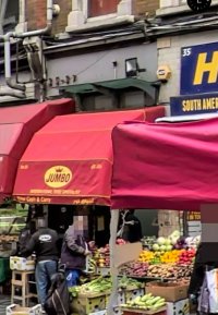
Market Row is not listed as a separate entity
Coldharbour Lane shows 'Porters Cottages' round where the Coldharbour Lane end is
View attachment 402960
The NLS 'map finder' button can bring up some map series that are only digitised on a sheet by sheet basis, rather than the sort you can move around, and some of London has 1930s issues, but not there. Having said that, I'm not sure there was a 1930s sheet that covers that patch - the LCC bomb damage map sheet for that area is 1916 issue.
Sod it.
Lambeth Archives / other local archives might have later kellys / post office directories, and ancestry have some online, but that's behind a paywall.
But the Historic England listing entry includes
so looks like it happened between the wars, and between OS map updates.


Having just been that way on my morning run, the Electric Avenue canopy has now been taken down as part of the current refit works. Still visible on streetview though. But, tbh it could be completely unrelated to the building behind and simply part of a tidying up of Electric Avenue/Pope’s Rd.Was it a Brixton Challenge project perhaps? There’s a small glass canopy over the Electric Avenue entrance that is identical to the one over the Pope’s Rd entrance to Brixton Village. Feels like a coordinated programme of town centre improvement.
Yep. Here's the Heritage Statement from the current planning application. It dates from the 1996 refurbishment.I have a vague memory that it (i.e. creation of the space previously occupied by Nour) was a LBL initiative in the 1990s intended to provide more market units.
Noticed yesterday that the covers are off. While it looks a lot smarter, it’s hardly a restoration job. A shame.Well it’s been under wraps since the summer, so I’ve high hopes they’re giving it a bit more than a lick of paint. It would be great to see the two-toning and the bronze detailing come back. Nothing on Lambeth planning database though, so that’s probably a bit of a stretch.
best I can say is
e2a: pies, fingers, many, Des
Wondered if anyone had any ideas or info about the grand looking balcony on Lambeth Town Hall, the one above the unused door on the Brixton Hill side of the building. Can anyone ever remember it being used? Any photos of anyone waving from it?
I've heard it called a 'proclamation balcony' but cant imagine it would be much use because of the busy road immediately outside.
somewhere i've got a monograph on london town halls - if i remember and find it, i'll see if it says anything about it.
The Brixton Hill elevation is long, grand and Ionic - 17 bays symmetrically arranged in a 1:6:3:6:1 rhythm around a central entrance. There is vertical enrichment to every window bay, and replacement glazing. The three-bay centrepiece is nicely composed in stone with distyle-in-antis columns allowing a recess for a mayor's balcony that has an ornate wrought-iron railing.
I was restarting the series of podcast episodes My Dad Mr Brixton - and funnily enough number 8 and 9 are now shown "coming soon"The podcast is excellent - thanks for that!
hi, my attention didn't flag actually I was gripped but I remember that the final episodes were not available. The author replied to me when I emailed her though, so try that maybe ... I would like to hear the rest tooI was restarting the series of podcast episodes My Dad Mr Brixton - and funnily enough number 8 and 9 are now shown "coming soon"
Every indication is that the complete set were launched originally. Were they there back in July - or did your attention flag, like mine?
There is some very interesting stuff about the 1960s and 1970s in the early episodes. It seems clear that Somerleyton and Geneva Roads were the epicentre of the Jamaican community at the time. This material would make a good book if illustration photos were available.
I am of course keen to know what Claudette's version of the last year of her father's life - and how she interprets Lambeth Council Social Services having him prosecuted for fraud. If anyone can help on the final 2 episodes let me know.
I suppose I could ask Claudette herself - the podcast has a gmail account.
Pic was taken during the riots. Saturday on April 10. At around 17:15 according to the info accompanying the picture.
You've "triggered" an old and now it seems false memory here.Saturday was 11 not 10 April in 1981.
If, as I suspect, the photograph was taken at around 5.15 p.m. on Saturday 11 April 1981, then this would be within 35 minutes of the actions of PC Cameron and PC Thornton that triggered the disorder in an incident with a mini-cab driver outside the offices of S&M Car Hire next to the All Star Takeaway. The photograph would have been taken just before or just after the first attacks on police vehicles and just before or just after the first police baton charge in Atlantic Road. The people in the picture are seen looking towards 'The Triangle' at the junction of Atlantic, Mayall and Railton Roads and beyond to 'the Frontline', where combatants would fully engage later in the evening.
If the photograph was taken at the stated time on Friday 10 April 1981, then this would be around a hour before the first outbreak of disorder in Atlantic Road and Vining Street on that day.
Queue outside the Brixton Astoria/Academy - 1950s?
Brixton Road c1905


I saw gold stars - one in each opposing quadrant - though I thought the background was plain white rather than "ermine".Back to the future? This was the Metropolitan Borough's flag in 1961.
Hope the new flag has "mullets or" (gold stars) added in the top right and bottom left quarters for the addition of the separate ancient parishes of Streatham and Clapham in 1965.
View attachment 409471

I've featured it before:


from flickr
photo has been colourised, taken at the top end of effra road looking north (about where windrush square is now) - slightly odd angle with the times furnishing company shop (now mcdonalds) just out of shot.
tram is going through the 'change pit' where trams changed between the conduit and overhead wire electrical supply - the 'plough' is being slid out from under the tram (this didn't require manual intervention) as it moves forward on overhead power. a supply of ploughs is ready for northbound trams, these required the attendant to use the two pronged fork thing to assist them in to position.